|
|
|
Advertisements:
Administrative divisions (603 GPS Maps)
Comments
Add a new comment: |
Advertisement
Members area
British Virgin Islands [ United Kingdom ] (Overseas Territory):
 
GPS points from British Virgin Islands [ United Kingdom ] (Overseas Territory)
|
||||||||

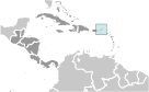 First inhabited by Arawak and later by Carib Indians, the Virgin Islands were settled by the Dutch in 1648 and then annexed by the English in 1672. The islands were part of the British colony of the Leeward Islands from 1872-1960; they were granted autonomy in 1967. The economy is closely tied to the larger and more populous US Virgin Islands to the west; the US dollar is the legal currency.